Stanford Area Trails
walk/run/bike/horse

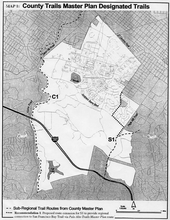
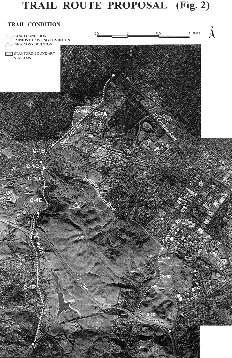
Maps from Stanford's proposal of August 31, 2001.

Fig. 1 from Stanford proposal.

This map was taken from a map in the County Trail Master Plan, with some changes for trail S-1.

Compare this map with the one below, and note that here, trail C-1 runs east of San Francisquito Creek on Stanford property in Santa Clara County, not along Sand Hill or Alpine Roads.

(Reproduced from a black and white copy. The original may have been in color)


Fig. 2 from Stanford proposal.

The proposed route runs along Sand Hill and Alpine Roads, as described, rather than through the Dish area.

Click on the image for a larger version.

(Reproduced from a black and white copy. The original may have been in color)

This site is operated by a group of Stanford-area people, many of whom are Stanford alumni.
It is not an official site of Stanford University.
Last update November 3, 2001.