Stanford Area Trails
walk/run/bike/horse
Mission
Action
Contact
Home
Trail plan
Dish area
San
Francisquito
Matadero
Missing links

Standards

Environment
Comments
Trail users
Walk
Run
Bike
Horse
Organizations
PATHS
SOS-alliance
Trail Center
Green Foothills
Background
Official
documents
Maps
and images

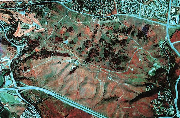
Dish area trail plan (draft)

The Stanford Dish area
(unrectified image - north is towards the upper left)

The Stanford Dish area has a sizable number of service roads and informal trails. Until August of 2000, Stanford permitted public use of most of these roads, trails, and paths. Since then, Stanford has restricted public use to the major paved roads.

Stanford is currently allowing public use of the following paved roads. (MAP and discussion to follow)

This site is operated by a group of Stanford-area people, many of whom are Stanford alumni.
It is not an official site of Stanford University.
Last update November 16, 2001.